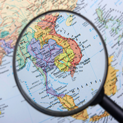
A 2013 RAND Corporation report titled 'Preparing for the Possibility of a North Korean Collapse' envisions, as its starting point, the reasonable probability that North Korean totalitarianism implodes in the foreseeable future, “accompanied by considerable violence and upheaval”. The 300-page report goes on to imagine in detail the range of challenges a Joint NATO and South Korean force could expect to face as it seeks to secure the rogue regime’s stockpile of nuclear weapons (estimates range as high as 50 warheads, all launchable from mobile platforms) and bring stability to the peninsula. Myriad issues are raised, such as the likely involvement of China understandably seeking to secure its own border with the collapsing state and the emergence of heavily armed crime gangs comprising whole former North Korean military units.
The report also describes a less-often considered challenge that has hampered the manoeuvre of military forces throughout every major conflict of the 20th and this Century – traffic. As NATO and South Korean mechanised divisions push north across the DMZ to secure the collapsed state and find the nukes, coalition troops can expect to run headlong into millions of North Korean refugees choking the narrow mountain passes (70% of the Korean Peninsula is covered by mountains). The need to provide food, shelter, and medical aid to these refugees will be the defining humanitarian challenge of its time. But the need to push thousands of troops and armoured fighting vehicles past them will present a manoeuvre challenge beyond any yet experienced in warfare.
All wars create refugees. Big wars generate big refugee flows. It is estimated that tens of millions of people were displaced in Europe alone during World War 2. This occurred at a time when the total global population was about 2.3 billion. It is now 8.1 billion. We can expect the number of refugees generated by the next major conflict to be proportionate to this population increase. Today, an isolated war between China and India alone would directly impact 500 million more people than were alive on Earth during World War 2.
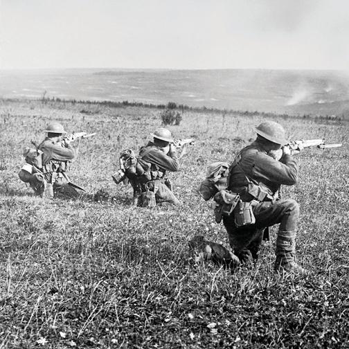
The mobility and manoeuvre support (MMS) function – coordinating the movement of friendly vehicles and troops through complex terrain – is a core military police (MP) role. The Australian Defence Force School of Policing is based at Lamia Barracks, named for the town near Thermopylae through which Australian Army provosts directed Allied forces, often under artillery and aerial bombardment, during the withdrawal from Greece in 1941. The Anzac Provost Corps also provided crucial MMS capability in the First World War. During the Third Battle of Ypres in 1917 for example, the bulk of traffic to and from the frontline passed through a narrow junction along the main supply route nicknamed “Hell Fire Corner”. The name reflected the continuous heavy enemy shelling of the obvious chokepoint. Australian provosts stood in the open on Hell Fire Corner directing vehicles to maintain the flow of supplies to the front and wounded to the rear. As one provost was killed or severely wounded by shrapnel from the constant artillery bombardment, another would step up to take his place and continue the work. The Third Battle of Ypres, also known as Passchendaele, lasted months. MPs still provide MMS support to major training exercises today. Although it has not been employed operationally for a while – being less important in the context of Australia’s recent deployments – MMS will be crucial in the next major conventional conflict, whether it is fought on the Korean Peninsula or anywhere else in the world.
A battle management system (BMS) can provide much of the MMS role that was once performed by provosts, assuming the system is available across all platforms, compatible with partner force systems, and not compromised by environmental factors, vehicle damage, the contested communications environment, computer glitches, or the digital literacy of the user. But BMS does not help refugees know where to go for aid and which areas to avoid, which routes are available to them and which are impassable due to minefields, destroyed bridges, enemy threat elements, road gangs, or high volumes of Coalition armoured fighting vehicles advancing at speed in the opposite direction.
It is for these reasons that I expect the MMS role to continue to be a vital MP contribution to the manoeuvre force. Even if all issues of coordinating friendly-force movements and marry-up are resolved by in-vehicle BMS in the next 20 years, those force elements will still need to coordinate movement through massive flows of refugees, internally displaced persons, and all the various NGO aid convoys and media presence that will be endemic to any major conflict now and into the future. No amount of technology will eliminate friction from war – computer systems will fail, communications will be disrupted, vehicles will break down, and elements of large formations will become detached from each other.
The MMS role will, however, likely look very different in 2045 than it did 104 years earlier on the streets of Lamia, or 128 years earlier at Hell Fire Corner. The iconic, and tragic, image of the MP pointsman courageously stepping into the open to continue directing vehicle movements after his mate was struck down by artillery will hopefully be absent from future battlefields. Autonomous, semi-autonomous, and remotely operated platforms will ideally replace the human provosts in the most dangerous roles.
In areas of operations crowded with autonomous platforms, an important element of MMS will involve the placement of nodes that support the friendly force’s systems while disrupting the enemy’s. In past conflicts, MP teams would hammer in signposts along roadsides to direct convoys carrying ammunition, food, and water towards resupply points behind the forward line of troops. MPs would establish traffic control points at key junctions along these routes to minimise confusion and prevent bottlenecks. In the future, semi-autonomous route-marking bots can perform these tasks with only minimal input from a control station far away from the fighting. As the resupply convoys themselves will also be autonomous, the route-marking bots need not be clearly identifiable to humans, but instead can use an encrypted marking system – think QR codes for which only friendly force elements have the key. They need not be displayed at all times, allowing them to camouflage along the route and only become visible when they receive a ping from an approaching friendly force element – the identity and purpose of the element indicating to the bots which route to display. This approach would allow a network of route-marking bots to provide bespoke directions to each friendly force element as it passes through, while also minimising the visibility and readability of route markings to enemy surveillance. In battlefields expected to be awash with GPS jamming and spoofing, physical route marking will continue to be necessary for years to come.
It is shortsighted, however, to use new technologies simply to do the same things we already do in slightly more efficient ways. True technological advancement means achieving things that couldn’t be done before. In the North Korean conflict scenario imagined above, directing resupply and reinforcement convoys through labyrinthine mountain passes behind the forward line of troops is only half of the MMS challenge. There remains the greater problem of the refugees ahead of advancing friendly force elements. MP units do not have the manpower or firepower to be spearheading armoured columns, nor are they appropriately prepared to operate behind enemy lines. Autonomous and semi-autonomous systems, however, can be forward deployed to direct refugee flows away from key lines of advance. They can communicate in the refugees’ own language and even adjust for regional dialects as required, employing both hard and soft traffic direction methods. Hard methods push refugees in a preferred direction using roadblocks, clear signposting and route guides – mobile bots that can move ahead of and among large clusters of civilians, showing the way to safety. Soft methods pull refugees in a preferred direction, such as by strategically establishing an unmanned food distribution point at a specific location to draw civilian traffic away from a key route about to be used by advancing friendly forces.
The MMS role is only one subset of MP support to combined arms operations that can, and must, evolve in the coming decades. MP forensic investigation capabilities will be essential to substantiate facts in a future likely to continue to be characterised by grey-zone actions and weaponised disinformation. MP security capabilities will need to keep up with technological advances that both support and subvert current methodologies. And MP internment and detention capabilities will need to be more mobile, with greater ability to expand capacity at short notice and more efficient systems for categorisation in conflicts that will likely involve captured persons of all classes.
As warfare becomes less human and more robotic, destructive power will become less effective than disruptive power. It is in this clouded and confused information environment where old-school MP capabilities, such as directing traffic, will prove to be vital manoeuvre force enablers.
